
AvNav CoPilot A new level of capability in your EFB app and a real flight assistant
 View full size
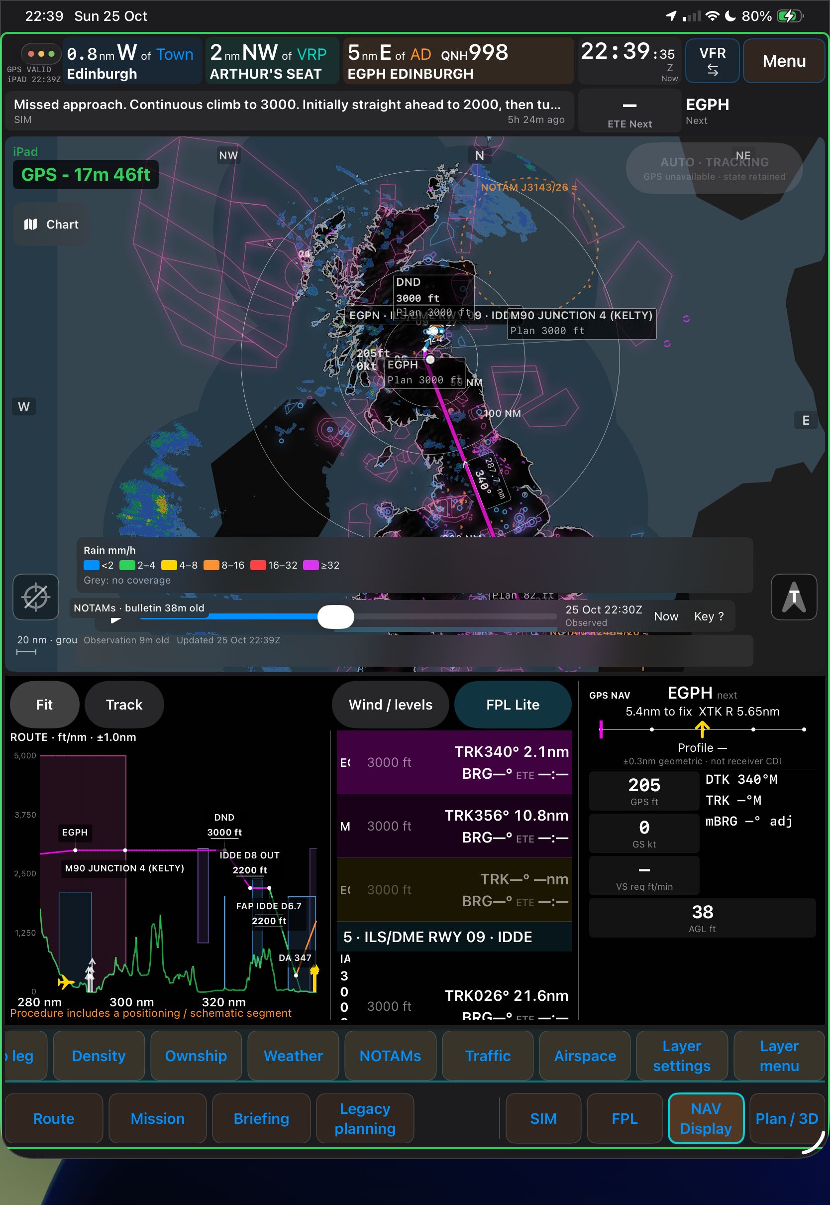
Weather overlays
Current and forecast overlays, including radar, winds aloft, cloud cover, cloud base, freezing level, precipitation, visibility and pressure charts.
 View full size
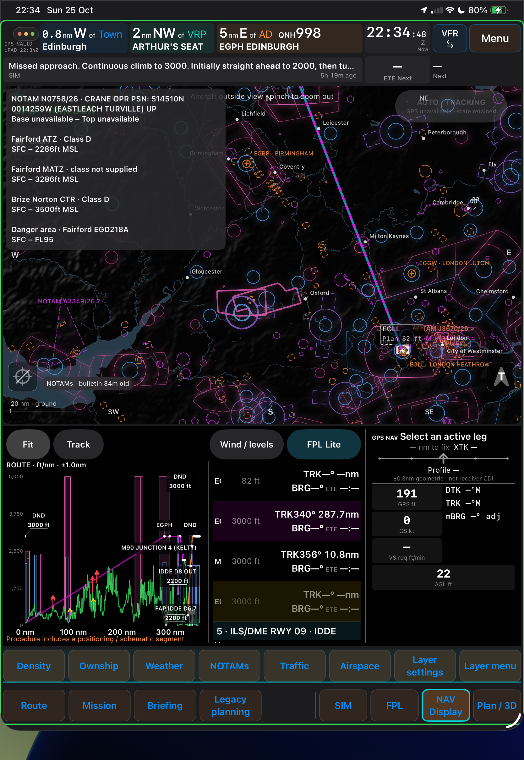
NOTAMs and airspace
NOTAMs and airspace information decoded into plain English, with proximity and infringement alerts.
 View full size
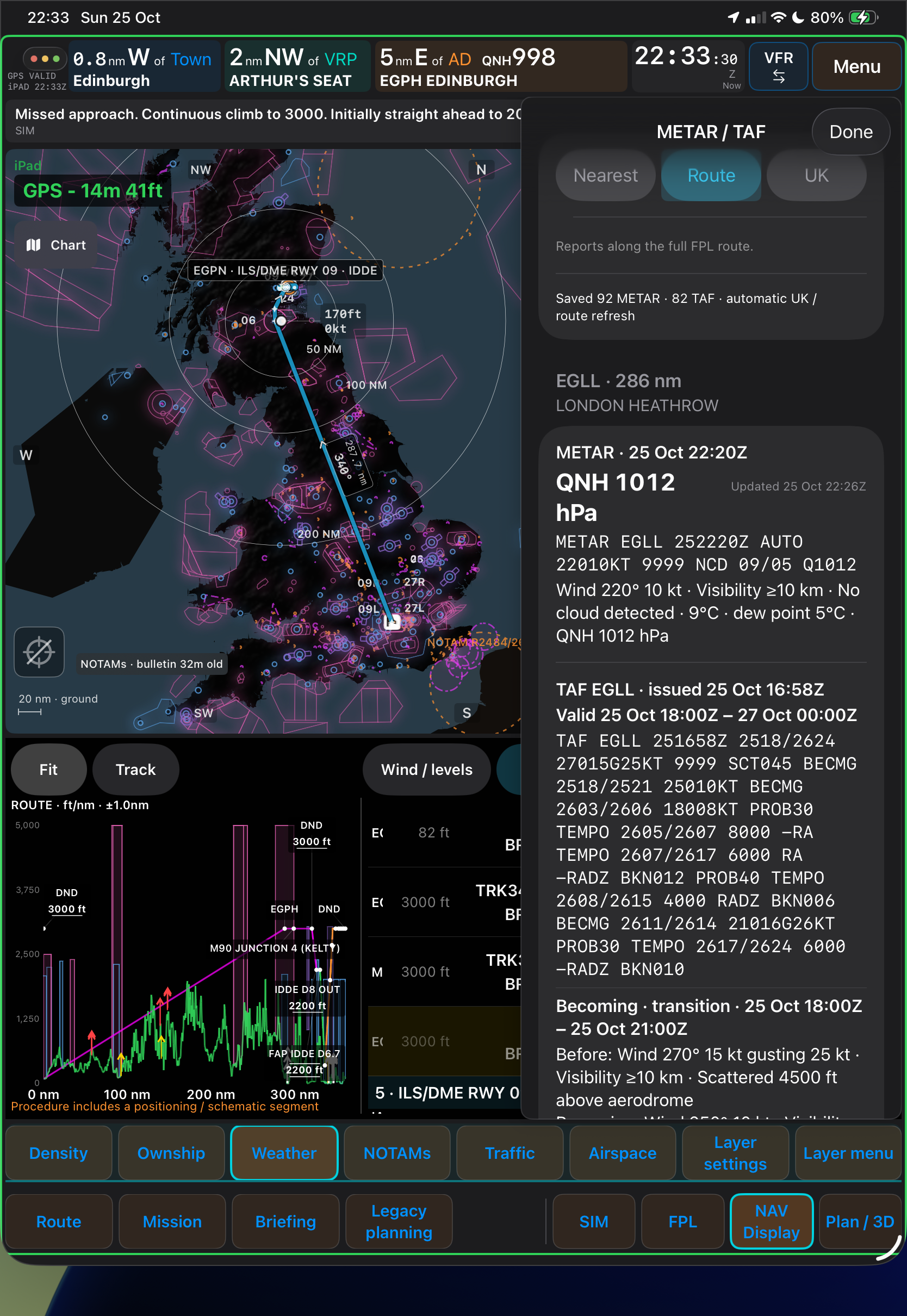
METARs and TAFs
Read METARs and TAFs in their original form or decoded into plain English, with automatic updates for your route.
 View full size
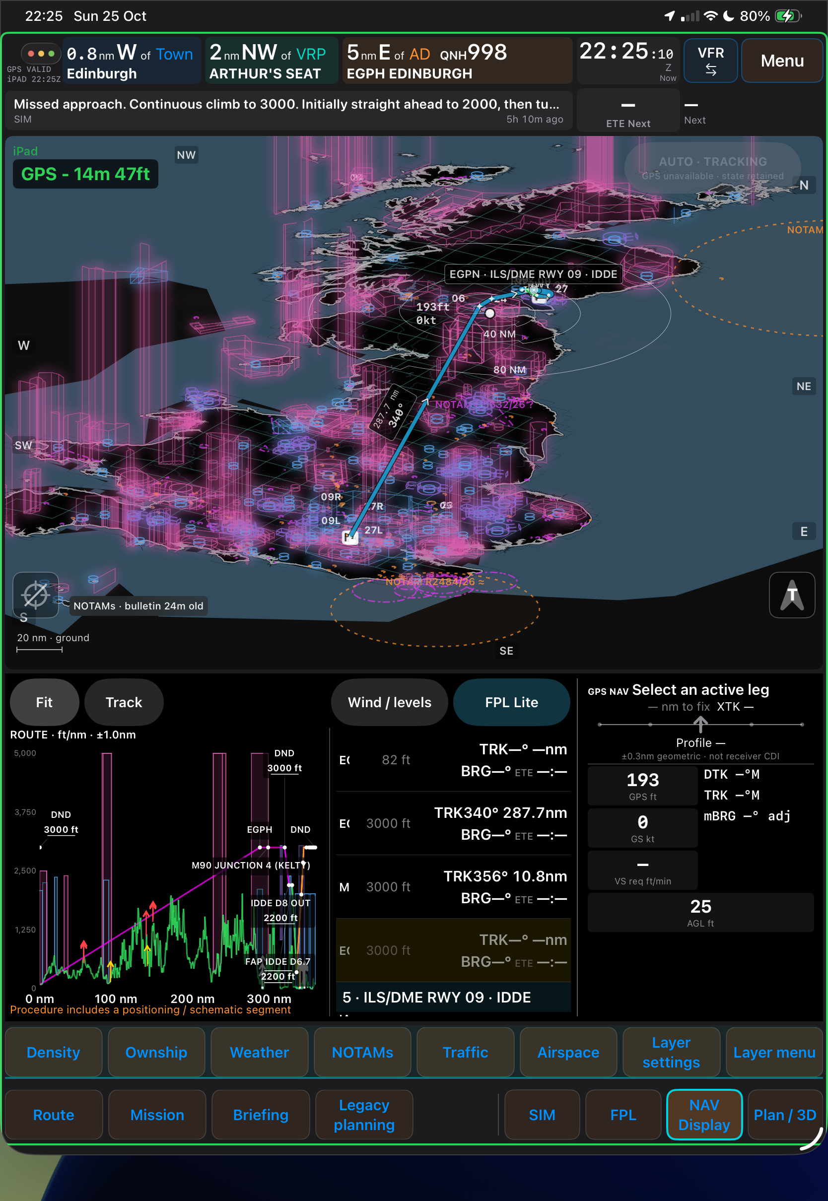
3D visualisations
Explore the map in 3D with flight following, pan, tilt and zoom across all map layers.
 View full size
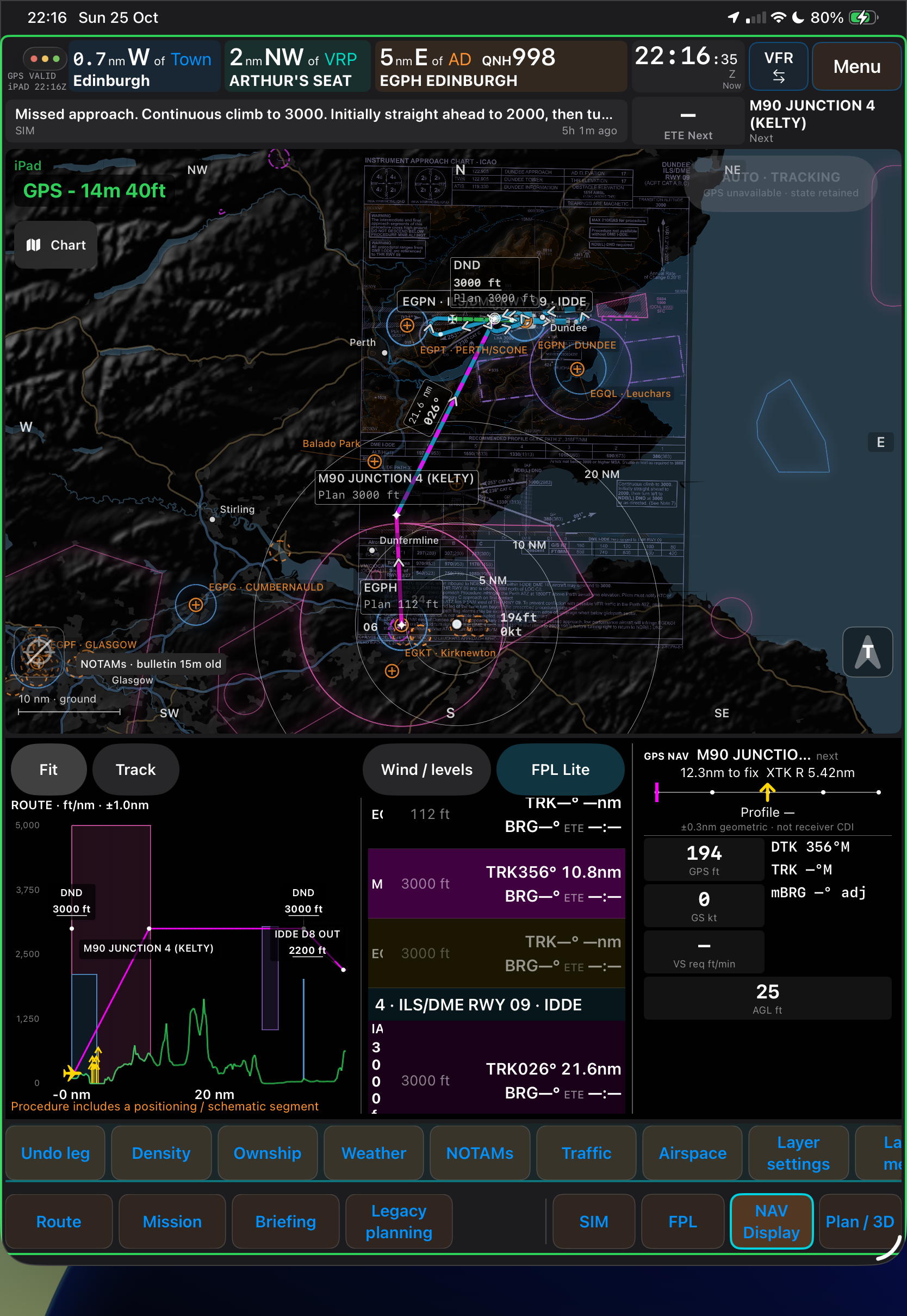
Official chart overlays
Official paper chart overlays in plan view, with the vertical profile always available.
 View full size
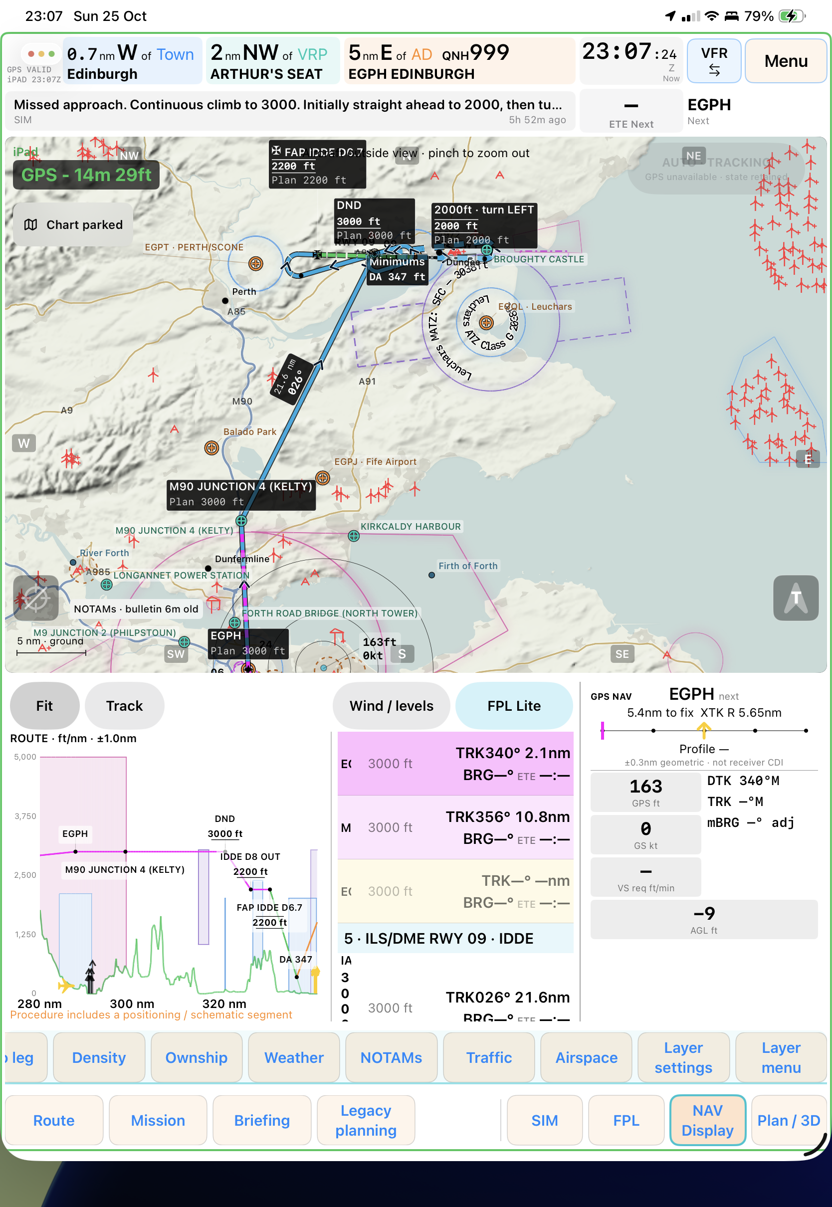
Day and night displays
Airspace, obstacles, NOTAMs, traffic and weather in plan, 3D and vertical profile views. Find route-specific weather, radio frequencies, aerodrome plates and charts, with planning, VFR, IFR and weather views one tap away.